


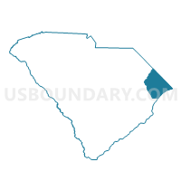
Methodist Rehobeth Voting District, Horry County, South Carolina
About
Outline

Summary
| Unique Area Identifier | 666063 |
| Name | Methodist Rehobeth Voting District |
| County | Horry County |
| State | South Carolina |
| Area (square miles) | 13.87 |
| Land Area (square miles) | 13.86 |
| Water Area (square miles) | 0.01 |
| % of Land Area | 99.95 |
| % of Water Area | 0.05 |
| Latitude of the Internal Point | 34.05996140 |
| Longtitude of the Internal Point | -79.15612530 |
Maps


Graphs
Select a template below for downloading or customizing gragh for Methodist Rehobeth Voting District, Horry County, South Carolina


Neighbors
Neighoring Voting District (by Name) Neighboring Voting District on the Map
- Aynor Voting District, Horry County, SC
- Galivants Ferry Voting District, Horry County, SC
- Joyner Swamp Voting District, Horry County, SC
- Mill Swamp Voting District, Horry County, SC
- Pleasant View Voting District, Horry County, SC
- Taylorsville Voting District, Horry County, SC